|
|
|
|
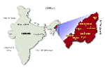
| Location |
25°6' and 27°4' North latitude, 93°20' and 95°15' East longitude |
| Area |
16,579 sq km (6400 sq mi) |
| Population |
1,988,636 (2001 census). [courtesy of www.censusindia.net ] |
| Religion |
Christianity |
| Capital |
Kohima, (1,444.12 metres above sea-level). |
| Districts |
Kohima , Mokokchung , Mon , Phek , Tuensang , Wokha , Zunheboto and Dimapur. |
| Climate |
Min : 4°C ,Max : 31°C |
| Rainfall |
2000 mm to 2500 mm |
| Main Rivers |
Dhansiri , Doyang , Dikhu , Milak , Zungki and Tizu. |
| Highest Peak |
Saramati (3,841 metres above sea-level) |
|
How to get there
By Air :
The only AIRPORT in Nagaland is in Dimapur, which is approximately (2.05) two and half Kms away from the main city. Which is about 10 - 15 minutes drive.
By Rail :
Nagaland has only one railway station which is also located in Dimapur, lies on the main line of North-Eastern Frontier Railway.
By Road :
Guwahati (Assam) - Dimapur, 292 kms
Shillong (Meghalaya) - Dimapur, 353 kms
Imphal (Manipur) - Dimapur, 216 kms
Dimapur - Kohima, 74 kms
Obtaining Entry Permits :
i) Domestic tourists visiting Nagaland require to obtain Inner Line Permits issued by the Deputy Resident Commissioner at Nagaland House, Delhi, Calcutta and Assistant Resident Commissioner, Shillong; Additional Deputy Commissioner, Dimapur; Deputy Commissioner, Kohima and Deputy Commissioner, Mokokchung. A permit fee of Rs. 5.00 is realised from each applicant. Detailed information can be had from the Directorate of Tourism, Nagaland, Kohima.
ii) Foreign tourists desiring to visit Nagaland require Restricted Area Permits, before entry into Nagaland. Which as per the new notification has been relaxed. click here to view the new notification.

|
|
|